![]()
|
|
|
|
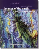
EDITORIAL INFORMATION Remote sensing has come of age. Nowadays we are all familiar with the aesthetic impact of images from space and take for granted the way that remote sensing permeates our lives, from the television weather forecast to helping ensure adequate provision of the resources involved in today's global economy. Focusing on visual information, Images of the Earth will engross any reader. Even more fascinating than the pictures, however, are the depth and clarity of the explanations behind them. These cover the ways instruments aboard satellites generate information, how the eye takes it in, and how the interpreter makes sense of it. With more than 200 illustrations as its framework, this text examines every facet of the Earth's surface: the ocean depths, the tracking of weather patterns, the productivity of forests and farms, the locations of mineral riches, the damage that we humans do, and the tragedy of nature's own catastrophes. (Extracted from the back cover)
GENERAL TABLE OF CONTENTS
OUR REVIEW Remote sensing is surely one of the main space applications. Its economic impact can't be overestimated and its importance has been growing each year since the early sixties. Drury, who has developed distance-teaching methods in the Earth Sciences as a lecturer at the Open University since 1971, has also researched since 1981 using satellites images in geology. So he knows very well how remote sensing has evolved and what its potential is. Using his great expertise in this field, he has prepared this new edition of Images of the Earth, offering all the reader can need. Very well illustrated, will be a welcome addition to the library of interested people. |
|||
![]()
Main Page | What's New | Reviews | Indexes | Links